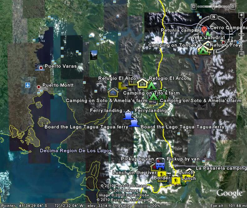
Alternatively, by clicking on the image on the left, all GPS tracks may be viewed in either Google Maps (in segments) or Google Earth - tracks courtesy of Ralph Pina.
|
|
|
|
|
|
|
|
This is a kml file detailing 3 weeks of trekking in Argentinean and Chilean
Patagonia in March 2010. There were 3 treks: |
|
|
|
|
Alternatively, by clicking on the image on the left, all GPS tracks may be viewed in either Google Maps (in segments) or Google Earth - tracks courtesy of Ralph Pina. |
|
Patagonia, Argentina & Chile [Intro-Pre Trip] [1] [2] [3] [4] [5] [6] [7] [8] [9] [10] [11] [12] [13] [14] [15] [16] [17] [18] [GPS Tracks] Other Tour Group photos (Picasa): [1 - Kelson & Elena] [2 - Ralph] [3 - Harald] |
|
Links to
|
|
Links to other websites: |
|
|
Copyright © Peter Groves unless otherwise stated. All rights reserved. |
|
|
|
|
|